Settlement and the Sea
The southern coastline of Nova Scotia stretches from the peninsula's southwestern tip near Yarmouth eastward to the Eastern Shore, passing through a series of small harbors that became the foundation of the province's fishing economy. The area now sometimes called the South Shore encompasses a band of settlement where geography — deep protected inlets, proximity to offshore banks, and a relatively mild maritime climate — made fishing the central occupation of communities for several centuries.
The earliest European fishing presence in these waters predates permanent settlement by more than a century. Seasonal stations, used by Basque, Portuguese, and French fishers to process cod and other groundfish, operated along the Atlantic coast from the early sixteenth century onward. When the British established the planned settlement at Lunenburg in 1753, they were settling a coast that already had a long, if temporary, European fishing presence.
The 1,453 foreign Protestant settlers brought to Lunenburg in 1753 came primarily from German-speaking regions of Europe. Within a generation, many had turned to the sea. The soils of the interior were workable but thin, and the harbors provided both food and a route to trade. By the early nineteenth century, Lunenburg County had developed into one of the more productive fishing districts in British North America.
The Dory and the Bank Fishery
The flat-bottomed, high-sided dory became the workhorse of the Nova Scotia inshore and offshore fishery during the nineteenth century. Designed to be stacked on deck and launched from larger schooners, dories allowed two-man crews to fish with hand lines and trawl lines over a wide area of the offshore banks before returning to the mother vessel.
The Grand Banks off Newfoundland and the Browns and Georges Banks southeast of Nova Scotia were the primary offshore grounds. Lunenburg schooners made regular trips to these grounds from late winter through fall, returning with holds of salted cod that were dried and processed ashore. The salt fish trade ran primarily to the Caribbean and to Catholic markets in southern Europe and Brazil, where demand for preserved cod was consistent throughout the year.
The Salt Fish Trade
Dried salted cod, sometimes called "bacalhau" in the Portuguese trade, formed the backbone of the Lunenburg fishing economy for much of the nineteenth and early twentieth centuries. The process of salting and air-drying fish on wooden "flakes" — raised platforms of split spruce boughs — was visible across virtually every waterfront in the South Shore communities.
The trade was highly seasonal and tied to the Catholic calendar in importing countries, where demand for preserved fish peaked during Lent and other fasting periods. The Lunenburg schooner fleet adjusted its departure and return schedules accordingly.
Community Structure Around the Fishery
The fishing economy shaped the physical layout of South Shore communities in ways that are still visible. Wharves, fish houses, and salt sheds occupied the waterfront, with residential streets rising behind them on whatever high ground the terrain provided. The spacing of settlements roughly corresponded to the distance a loaded wagon could travel to a salt fish merchant in a day, resulting in a series of small harbors — Mahone Bay, Chester, Lunenburg, La Have, Bridgewater — each with its own processing infrastructure.
Processing work was divided along gender and age lines. Men and older boys crewed the vessels and worked the lines offshore, while women and younger children participated in the shore-side work of splitting, salting, and turning fish on the drying flakes. This domestic labor was economically essential but was rarely recorded in the same formal ledgers that tracked vessel tonnage and fish prices.
The fish merchants who operated the buying and processing houses occupied a pivotal position in the local economy. They advanced supplies and credit to fishing families against future catches, a system that created long-term financial relationships between processors and fishers that could persist across generations. The archives of the Lunenburg-based firms that engaged in this trade survive in part at the Nova Scotia Archives in Halifax.
Transition to Engine Power
The introduction of gasoline and diesel engines to the Nova Scotia fishery during the early twentieth century fundamentally altered the scale and geography of the inshore fishery. Smaller vessels that had previously been limited to waters within rowing or sailing distance of the home harbor could now reach grounds farther offshore and return more quickly. The dory fleet of large schooners did not disappear immediately, but engine-powered draggers and longliners gradually displaced sail-assisted vessels on the offshore banks.
By the 1950s, the Lunenburg fleet had shifted primarily to diesel-powered vessels. The processing industry, meanwhile, consolidated around larger plants capable of handling frozen rather than just salted product. Companies such as National Sea Products, established in Lunenburg, grew into significant enterprises that processed fish from across the Atlantic Canadian fleet.
The groundfish stocks that had supported the bank fishery for centuries began showing serious signs of depletion by the 1970s and 1980s. The cod moratorium declared by the Canadian federal government in 1992 — applied first to the northern cod stock off Newfoundland — marked a formal acknowledgment that the offshore groundfish fishery had been fundamentally altered by decades of industrial-scale harvesting. Subsequent stock assessments and regulatory changes reshaped the economics of the South Shore fishery in ways that communities are still navigating.
Inshore Fisheries and Present-Day Communities
The inshore fishery — defined in Canadian federal regulation as fishing conducted within a defined zone close to shore, typically by vessels under a certain length — has remained economically significant in South Shore communities even as the offshore groundfish fishery contracted. Lobster in particular became the dominant commercial species in the South Shore region during the latter half of the twentieth century.
The management of the lobster fishery in Atlantic Canada is organized around a system of Lobster Fishing Areas (LFAs), each with defined seasons, trap limits, and licensing requirements administered by Fisheries and Oceans Canada (DFO). The structured seasonal opening of the lobster fishery — different LFAs open at different times of year — gives South Shore harbors a rhythm that remains closely connected to the fishing calendar.
The physical infrastructure of the inshore fishery — wharves, gear storage buildings, bait operations, and buyer facilities — continues to define the waterfront character of communities from Peggy's Cove to Barrington Passage. The federal Small Craft Harbors program, administered through DFO, manages many of the wharves and facilities used by the inshore fleet, and its maintenance funding decisions directly affect the operational capacity of fishing communities.
Heritage and Documentation
Lunenburg was designated a UNESCO World Heritage Site in 1995. The designation recognized the town's well-preserved grid street plan and the survival of its distinctive wooden architecture, much of which dates from the late nineteenth and early twentieth centuries. The UNESCO listing notes the direct connection between the built environment and the fishing economy that created it: the large wooden houses, the churches built with fishing wealth, and the commercial waterfront structures all reflect the prosperity generated by the bank fishery at its height.
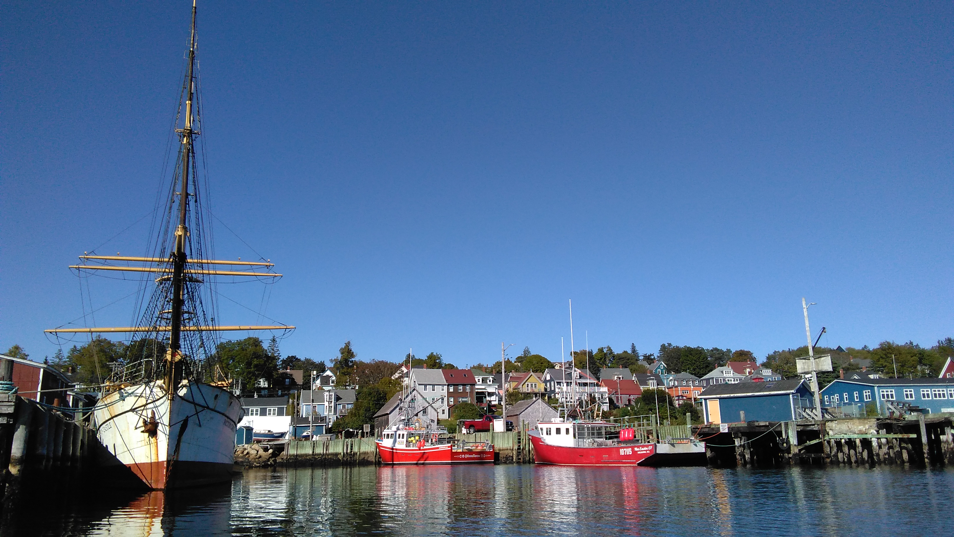
The Fisheries Museum of the Atlantic, located on Lunenburg's waterfront, holds collections related to the history of the Nova Scotia fishery including vessel artifacts, fishing gear, and documentary records. The museum's floating exhibit includes historic vessels that allow visitors to examine the physical scale of the vessels that worked the offshore banks.
The UNESCO designation for Lunenburg recognizes the town as an outstanding example of a planned British colonial settlement. The layout and architecture reflect the fishing economy that sustained it from the eighteenth century onward.
The documented history of South Shore fishing communities is held in various institutional collections, including the Nova Scotia Archives, the Public Archives of Nova Scotia, and the holdings of local historical societies in Lunenburg, Chester, Mahone Bay, and Bridgewater. Parish records, vessel registrations, and fish merchant account books provide the most detailed picture of the day-to-day economics of the fishery over time.
Sources: Parks Canada, UNESCO World Heritage Centre, Fisheries and Oceans Canada (DFO), Nova Scotia Archives, Fisheries Museum of the Atlantic (Lunenburg).